Batu Pahat / Minyak Beku coastal visit

Why Is It Called Batu Pahat? Follow the Story to Minyak Beku

Discover the stories behind Batu Pahat's name at Minyak Beku, pair a coastal stop with Dataran Penggaram, and look beyond a quick seaside photograph.

Ask route quote
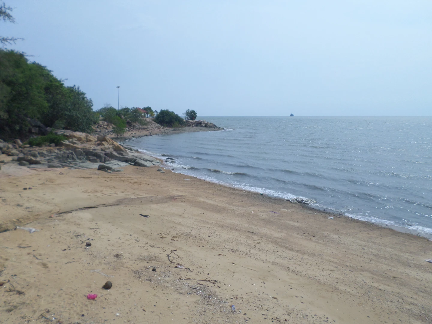
Rocky shoreline and sea at Minyak Beku Beach in April 2016; the historic well is not shown/2016年4月石文丁海岸与礁石,照片并未展示古井

A town name that changes the way you see a coastline

You can visit a seaside place, take a photograph and leave with very little to remember. Minyak Beku offers another starting point: why does Batu Pahat carry a name associated with chiselled stone? The interest here is not a promise of an untouched beach or a secret attraction. It is the connection between a familiar town name, a coastal well and the stories people use to explain their surroundings. Choose this stop if that kind of small discovery sounds more appealing than collecting another busy itinerary.

Listen to the well story as a legend, not a proven event

The Batu Pahat district profile recounts a legend of Siamese troops chiselling rock to obtain water in the fifteenth century. It also records another explanation linking stone quarrying to the construction of A Famosa in Melaka. Those are different accounts; this guide does not combine them into one established history. Read the district profile, then look for what the interpretation at the site actually says. A good question for the journey is: how can one place keep more than one story about its name?

Give the sea a little attention too

Johor's tourism map identifies Pantai Minyak Beku with its old well and a view towards the Strait of Malacca. Once you have considered the name story, put the camera down for a moment. Notice the boundary between land and water and how different a coastal stop feels from the town centre. These are suggestions for looking, not claims of a guided activity. Keep to accessible visitor areas; do not climb slippery rocks for a matching photograph or treat this article as advice that swimming is suitable.

A town-square connection makes the story easier to remember

The same tourism map highlights the stone-and-chisel monument at Dataran Penggaram. You could pair a town-centre stop with the coastal story, then compare how a place name is represented in sculpture and in a local legend. That is a theme for your outing, not a fixed two-stop tour. Pick the order around where you are staying or eating, and confirm the actual addresses. Do not assume the square and the coast form one short walking route.

Try a three-picture story rather than a long checklist

If photography is part of the fun, give each picture a job: one wide view for the setting, one permitted close view of a detail or information sign, and one town scene that connects the name back to everyday life. Someone who prefers writing could sum up the stop in a sentence instead. With children, ask what they thought the name meant before the visit and what they think afterwards. Nobody needs to invent an answer when a sign is unclear; an unanswered question can be a reason to read more.

Who will enjoy it, and who might prefer another outing?

This is a good idea for visitors who enjoy modest heritage stops, local names and unhurried coastal views. It may be less satisfying if the group wants a full afternoon of organised entertainment or guaranteed beach facilities. Let a town meal or another independently checked activity carry the rest of the day. Travelling with older relatives or a stroller? Confirm the current drop-off, surface and walking distance locally; a photograph of the shore cannot prove step-free access. Allow for heat and rain rather than planning the entire visit around a perfect sunset.

A few questions before you go

Is the well story verified history? This article presents it as a legend recorded by the district authority. Is the well in the photograph? No, the image shows the coastal setting. Can we assume the water is drinkable? No; do not draw a drinking-water conclusion from a historical story. Are opening arrangements or facilities guaranteed? No current schedule or facility guarantee is made here. Check on-site access and local notices before making a special journey.

About the real photograph

Minyak Beku shoreline photographed by Chongkian on 17 April 2016, CC BY-SA 4.0. Resized/WebP and responsive crop; historical coastal context, not a photograph of the well or current access conditions./Chongkian摄于2016年4月17日,CC BY-SA 4.0;缩放、转WebP及响应式裁切。历史海岸照片,不是古井照片,也不证明今天的通行情况。

Photo reuse and editorial independence

The adapted photograph retains its CC BY-SA 4.0 licence. The photographer is credited, not presented as a customer or an endorser of our transport service.

Turn the idea into a clear Batu Pahat transport enquiry

For a Singapore-origin trip, send your date, Singapore pickup, Batu Pahat destination pins and intended stop order. Include passenger and luggage details, children or mobility needs, waiting requests and the return destination so vehicle fit and quote factors can be checked. Border traffic, road conditions and weather affect timing; do not book the day around a guaranteed arrival. Use the Batu Pahat route page for transport, with final fare and arrangements confirmed on WhatsApp. No attraction ticket or local activity is bundled by this article.

Continue planning

Use the route owner and practical planning pages

Ask about your Batu Pahat journey

Send the Minyak Beku destination pin, date, pickup, stops and return details so the route and fare can be confirmed.

WhatsApp for Batu Pahat
Quote